From near Waipu Cove to south of Mangawhai township, near the top end of Te Arai Beach - 33 km - 7.5 hours
From the main road near Waipu Cove, the day started with a walk up a road into the Brynderwyn Hills. The road became a shingle vehicle track winding up through the pines - then near the top there was a car coming down - from one of several houses in the trees right at the top.
Then a fairly straightforward following of the orange marker posts and my GPS and map along the tops - as promised there were a number of side tracks to watch out
 for.
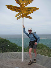
for.Then down through some good patches of regenerating kauri to cross the main Waipu to Mangawhai road, next up (and down and up) again through some very parched farmland to reach the Mangawhai Cliffs walkway. I followed that high up the cliffs for a way with some spectacular views (picture), down to the beach, and then to the town of Mangawhai Heads.
A super estuary to walk around, and then up to the main road for a walk around to Mangawhai (Point) township, and then on via a dusty back road to the start of the forest road that will tomorrow take me onto Te Arai Beach

No comments:
Post a Comment