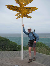
While I was waiting to get back up to Northland to complete the leg to Auckland, I started on the closer sections of the Te Araroa route south from Auckland. This is in a new blog - Tony on Te Araroa 2 - so click on that link to track my progress further south.
So far from Cape Reinga to home in Auckland I have covered 639 km in 21 days' walking, with an average day being 30.4 km, 7.3 hours and 4.2 kph. A lot of variation within that - the slowest days including serious tramping tracks.
Sunday, March 14, 2010
Redvale to Epsom
38.8 km - 7.6 hours
From Redvale (north east of Albany) it was road walking for a bit to get to Long Bay, continuing my bypass of the muddy Okura River. From there down the coast through all the North Shore Bays, with super beaches, and super views from up on the cliffs in between. Took advantage of the outgoing tide to skip some of the cliffs and roads, including continuing at sea level from the south end of Takapuna beach through to Narrow Neck beach (You can't do that at a high tide).
On Cheltenham Beach I paused briefly to watch two of the Loius Vuiton y achts rounding a mark, and then headed off to Devonport to catch the ferry to downtown Auckland. Then a very familiar walk on the Coast to Coast walkway (where I broke the back of my Oxfam Trailwalker training a few years ago) through the university, Auckland Domain, and up to the summit of Mt Eden (view looking back to Rangitoto - pic) before heading to my home in Epsom
From Redvale (north east of Albany) it was road walking for a bit to get to Long Bay, continuing my bypass of the muddy Okura River. From there down the coast through all the North Shore Bays, with super beaches, and super views from up on the cliffs in between. Took advantage of the outgoing tide to skip some of the cliffs and roads, including continuing at sea level from the south end of Takapuna beach through to Narrow Neck beach (You can't do that at a high tide).
On Cheltenham Beach I paused briefly to watch two of the Loius Vuiton y
 achts rounding a mark, and then headed off to Devonport to catch the ferry to downtown Auckland. Then a very familiar walk on the Coast to Coast walkway (where I broke the back of my Oxfam Trailwalker training a few years ago) through the university, Auckland Domain, and up to the summit of Mt Eden (view looking back to Rangitoto - pic) before heading to my home in Epsom
Saturday, March 13, 2010
Wenderholm to Redvale (just north of Auckland)
28.5 km - 6.8 hours
A later start than usual to ensure the tide was OK - so left Wenderholm at the canoe landing place at 9.40 heading up a much improved track around the Wenderholm peninsula, with great views down to the river mouth, out to sea, and in the distance, what was probably the Dome summit.
The track then continued on down and around, taking me to the bridge at Waiwera , and from there it was out to the beach for the low tide section. This was a mixture of beach (cliff picture) and rock walking and rock scrambling all the way around to Hatfields Beach. Then various paths up the next hill, with a great view down Orewa Beach. Along that beach (mostly not on sand), to the western end of the Whangaparoa Peninsula and after not too long down to the northern edge of the Weiti River.
An obliging boatie rowed me across to a non muddy landing spot, so then I was off again on the Okura walk - the first part taking advantage of the lowish tide to skip a few hills. The official Te Araroa route involves a muddy Okura River crossing, so I skipped that and continued on the bush track to its end, walking up to East Coast Bays road for my pickup for the day.
28.5 km - 6.8 hours
A later start than usual to ensure the tide was OK - so left Wenderholm at the canoe landing place at 9.40 heading up a much improved track around the Wenderholm peninsula, with great views down to the river mouth, out to sea, and in the distance, what was probably the Dome summit.
The track then continued on down and around, taking me to the bridge at Waiwera
 , and from there it was out to the beach for the low tide section. This was a mixture of beach (cliff picture) and rock walking and rock scrambling all the way around to Hatfields Beach. Then various paths up the next hill, with a great view down Orewa Beach. Along that beach (mostly not on sand), to the western end of the Whangaparoa Peninsula and after not too long down to the northern edge of the Weiti River.
An obliging boatie rowed me across to a non muddy landing spot, so then I was off again on the Okura walk - the first part taking advantage of the lowish tide to skip a few hills. The official Te Araroa route involves a muddy Okura River crossing, so I skipped that and continued on the bush track to its end, walking up to East Coast Bays road for my pickup for the day.
Friday, March 12, 2010
Dome Tearooms to Puhoi
Friday 12th March
Dome Tearooms - pine forest - farmland - pine forest - Moir Hill - Dunns Ridge - Puhoi village. 26.5 km - 5.75 hours
Leaving into a shower or two (first rain since before Kerikeri) up a minor road soon leaving the sound of a busy SH1 behind me. Then along forest roads, with a short connecting foot track, down into Streamlands, then more minor roads and farm paddocks to the start of the walk into the pine plantation leading to Moir Hill.
Forest roads then wound there way steadily uphill until the cellphone tower on Moir Hill was reached. Fried there for a while before heading down a minor forest track, cr ossing a minor road, through a new subdivision and onto Dunns Ridge Track. This took me down through open bush, before reaching an open ridge down through a farm to the quiet roads that then led me to the village of Puhoi.
The next section of Te Araroa is via canoe down the river to Wenderholm - I had done that with the family in January (picture) - just as well, since on checking, Puhoi Canoes had other plans for tomorrow, so tomorrow I will be starting from Wenderholm
Dome Tearooms - pine forest - farmland - pine forest - Moir Hill - Dunns Ridge - Puhoi village. 26.5 km - 5.75 hours
Leaving into a shower or two (first rain since before Kerikeri) up a minor road soon leaving the sound of a busy SH1 behind me. Then along forest roads, with a short connecting foot track, down into Streamlands, then more minor roads and farm paddocks to the start of the walk into the pine plantation leading to Moir Hill.
Forest roads then wound there way steadily uphill until the cellphone tower on Moir Hill was reached. Fried there for a while before heading down a minor forest track, cr
 ossing a minor road, through a new subdivision and onto Dunns Ridge Track. This took me down through open bush, before reaching an open ridge down through a farm to the quiet roads that then led me to the village of Puhoi.
The next section of Te Araroa is via canoe down the river to Wenderholm - I had done that with the family in January (picture) - just as well, since on checking, Puhoi Canoes had other plans for tomorrow, so tomorrow I will be starting from Wenderholm
Thursday, March 11, 2010
Matakana to Dome Tearooms SH1
Thursday 11th March
From Matakana township up the valley and then up the hill soon joining the track through the Waiwhiu valley and up again to the Dome summit, then down to the Dome tearooms on SH1 just north of Warkworth - 21.6 km - 5.5 hours
One day the Matakana dogleg of busy roads will be replaced by the Western Tamahunga track. But not yet, so up the valley road from the township to the hills, and then winding up and up to a minor road turnoff. Along that road with views out to the north as far as the Mangawhai Cliffs and Whangarei Heads which I now know a lot better than a week ago.
Then to the start of the tramping track that goes first along a forest road, t hen wends its way down a ridge line into the Waiwhiu Valley. The track winds its way on the hill side of the stream for a while, then does a quick dive across the stream at a place of large boulders (picture), and then out into the open on a forestry road. A side road then goes up the other side of the valley, before the tramping track resumes near the top. That then follows the ridge line around to the Dome summit (with views out to Omaha / Kawau), and then heads down to the end of the track on the side of SH1
From Matakana township up the valley and then up the hill soon joining the track through the Waiwhiu valley and up again to the Dome summit, then down to the Dome tearooms on SH1 just north of Warkworth - 21.6 km - 5.5 hours
One day the Matakana dogleg of busy roads will be replaced by the Western Tamahunga track. But not yet, so up the valley road from the township to the hills, and then winding up and up to a minor road turnoff. Along that road with views out to the north as far as the Mangawhai Cliffs and Whangarei Heads which I now know a lot better than a week ago.
Then to the start of the tramping track that goes first along a forest road, t
 hen wends its way down a ridge line into the Waiwhiu Valley. The track winds its way on the hill side of the stream for a while, then does a quick dive across the stream at a place of large boulders (picture), and then out into the open on a forestry road. A side road then goes up the other side of the valley, before the tramping track resumes near the top. That then follows the ridge line around to the Dome summit (with views out to Omaha / Kawau), and then heads down to the end of the track on the side of SH1
Wednesday, March 10, 2010
Mangawhai to Matakana

Wednesday 10th March
Te Arai beach - Pakiri - up and over Mt Tamahunga - roads to Matakana - 31.4 km - 7.6 hours
Onto the top end of Te Arai beach, then down the beach, with Te Arai Point to climb over part way along. Then on for another couple of hours to Pakiri - with racing horses training their silky riders on the beach for something a little different. An easy wade through the Pakiri river near the mouth, and then via a dusty road to the start of the real hill section for the day.
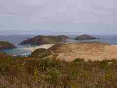
This climbed steeply up through dry paddocks to a ridge top with views to the north (picture) and then up and down, and then up again to the top of Mt Tamahunga, now with views out east to Omaha and Kawau Island. Down the other side, onto a road, that soon became the busy road from Leigh to Matakana.
Now able to stay at home in Auckland, so a chance to catch up with my blog .. and the rest .. while I finish off the last of the north Auckland section in the next few days
Waipu to Mangawhai
Tuesday 9th March
From near Waipu Cove to south of Mangawhai township, near the top end of Te Arai Beach - 33 km - 7.5 hours
From the main road near Waipu Cove, the day started with a walk up a road into the Brynderwyn Hills. The road became a shingle vehicle track winding up through the pines - then near the top there was a car coming down - from one of several houses in the trees right at the top.
Then a fairly straightforward following of the orange marker posts and my GPS and map along the tops - as promised there were a number of side tracks to watch out for.
for.
Then down through some good patches of regenerating kauri to cross the main Waipu to Mangawhai road, next up (and down and up) again through some very parched farmland to reach the Mangawhai Cliffs walkway. I followed that high up the cliffs for a way with some spectacular views (picture), down to the beach, and then to the town of Mangawhai Heads.
A super estuary to walk around, and then up to the main road for a walk around to Mangawhai (Point) township, and then on via a dusty back road to the start of the forest road that will tomorrow take me onto Te Arai Beach
From near Waipu Cove to south of Mangawhai township, near the top end of Te Arai Beach - 33 km - 7.5 hours
From the main road near Waipu Cove, the day started with a walk up a road into the Brynderwyn Hills. The road became a shingle vehicle track winding up through the pines - then near the top there was a car coming down - from one of several houses in the trees right at the top.
Then a fairly straightforward following of the orange marker posts and my GPS and map along the tops - as promised there were a number of side tracks to watch out
 for.
for.Then down through some good patches of regenerating kauri to cross the main Waipu to Mangawhai road, next up (and down and up) again through some very parched farmland to reach the Mangawhai Cliffs walkway. I followed that high up the cliffs for a way with some spectacular views (picture), down to the beach, and then to the town of Mangawhai Heads.
A super estuary to walk around, and then up to the main road for a walk around to Mangawhai (Point) township, and then on via a dusty back road to the start of the forest road that will tomorrow take me onto Te Arai Beach
Whangarei Heads to Waipu area
Monday 8th March
Reotahi Bay, then Marsden Point to near Waipu Cove - 32.8 km - 50 mins plus 5.75 hours
A split day - first an early morning walk from the motel, down to Little Munro Bay, then around the point to Reotahi Bay, with the ever present Marsden Point oil refinery just across the harbour. Then a drive around the harbour through Whangarei and out to Marsden Point.
Walking started along the south side of the harbour, under the jetty and pipes for unloading oil from the tanker ships, and then it turned into the Bream Bay beach, heading SW down to Ruakura. Being a highish tide, with a real river to be crossed, it was then a road deviation out to the main road past the town, along that and some, before heading back past the motor camp to the beach again.
Then another hour on the beach, before heading inland again for the roads to take me over the Waipu River. A flat and dry area, but views back to the Whangarei Heads where I was yesterday, and onto the Brynderwyn Hills where I will be tomorrow. Tried to rejoin the estuary section (low tide route) for the last few kms, but the tide was still too high.
Whangarei Heads
Sunday 7th March
Near to and over Kauri Mountain - Ocean Beach - along the tops at Whangarei Heads then around the foreshore to near Little Munro Bay - 29 km - 8.75 hrs
An early morning walk along a quiet rural road, then up and up a private road (with some misleading markings), but then reached the top of Kauri Mountain with coastal views off to the north. Down the other side, then after a short road stretch, clambered down onto Ocean Beach, with Bream Head and the rest of the Whangarei Heads peaks clearly in view. Getting on for high tide, so had a bit of a scramble up an unstable bluff to get down to the last stretch of the beach that has public access. Collected some more gear in anticipation of a blustery tramp along the length of the hills at the Whangarei Heads
In the event it was a hot climb, and very up and down once at the top, so grateful to find that the track at the tops is mostly in bush, but enough views and glimpses of the sea a long way below to
get a feeling of height. Some amazing rocky outcrops - Bream Head - Matariki - unnamed (picture), and on towards Mt Lion. Super views to the north, the south, and coming down Mt Lion, the nearby bays and past Marsden Point and up the Whangarei Harbour. A real knee killer of a track coming down, so a time to be slow and careful. No wind, so that extra gear ... had a good ride !
Reached my pickup point for the day at the road end, but after a short break, I dumped my pack and boots, donned sandals, and walked for an hour on the next section of Te Araroa, to the point where it came to within 140m of our motel.
Near to and over Kauri Mountain - Ocean Beach - along the tops at Whangarei Heads then around the foreshore to near Little Munro Bay - 29 km - 8.75 hrs
An early morning walk along a quiet rural road, then up and up a private road (with some misleading markings), but then reached the top of Kauri Mountain with coastal views off to the north. Down the other side, then after a short road stretch, clambered down onto Ocean Beach, with Bream Head and the rest of the Whangarei Heads peaks clearly in view. Getting on for high tide, so had a bit of a scramble up an unstable bluff to get down to the last stretch of the beach that has public access. Collected some more gear in anticipation of a blustery tramp along the length of the hills at the Whangarei Heads
In the event it was a hot climb, and very up and down once at the top, so grateful to find that the track at the tops is mostly in bush, but enough views and glimpses of the sea a long way below to
get a feeling of height. Some amazing rocky outcrops - Bream Head - Matariki -
 unnamed (picture), and on towards Mt Lion. Super views to the north, the south, and coming down Mt Lion, the nearby bays and past Marsden Point and up the Whangarei Harbour. A real knee killer of a track coming down, so a time to be slow and careful. No wind, so that extra gear ... had a good ride !
Reached my pickup point for the day at the road end, but after a short break, I dumped my pack and boots, donned sandals, and walked for an hour on the next section of Te Araroa, to the point where it came to within 140m of our motel.
Ngunguru to near Kauri Mountain
Saturday 6th March
near Ngunguru to near Kauri Mountain - 35.7 km - 8 hours
Today was mostly a road walk day, starting from 2.3 km west of Ngunguru (near Tutukaka), with 10 km on the road to Whangarei to get to the head of the Ngunguru estuary, and then head back along a minor road to the start of the Mackerel Forest Walk.
That started off pleasantly through a pine plantation that looks set to get the chop soon, down to the Waitangi River - the walk description said knee / thigh depth, but actually was not much more than ankle deep - very dry right now. Then followed the stream on the ed ge of a logged area, with the track being that bit harder to follow, and with gorse to make it that more ... interesting. Some swampy areas too, before climbing up through a mature forest and out onto my next road.
This headed off to the Horahora Estuary (mangroves galore) and then around to Pautaua where again the only way across the estuary was via a footbridge - with people jumping off into the turquoise river below (picture). Then on to the Tahururu Estuary getting close to high tide, so not being a strong swimmer, the alternative to the Te Araroa low tide route took me to the corner of Tahururu and Pautau roads.
near Ngunguru to near Kauri Mountain - 35.7 km - 8 hours
Today was mostly a road walk day, starting from 2.3 km west of Ngunguru (near Tutukaka), with 10 km on the road to Whangarei to get to the head of the Ngunguru estuary, and then head back along a minor road to the start of the Mackerel Forest Walk.
That started off pleasantly through a pine plantation that looks set to get the chop soon, down to the Waitangi River - the walk description said knee / thigh depth, but actually was not much more than ankle deep - very dry right now. Then followed the stream on the ed
 ge of a logged area, with the track being that bit harder to follow, and with gorse to make it that more ... interesting. Some swampy areas too, before climbing up through a mature forest and out onto my next road.
This headed off to the Horahora Estuary (mangroves galore) and then around to Pautaua where again the only way across the estuary was via a footbridge - with people jumping off into the turquoise river below (picture). Then on to the Tahururu Estuary getting close to high tide, so not being a strong swimmer, the alternative to the Te Araroa low tide route took me to the corner of Tahururu and Pautau roads.
Whananaki to Ngunguru
Friday 5th March - Whananki North to past Ngunguru - 25.8 km - 6.5 hours
Crossing the long Whananaki Estuary footbridge there were children coming in the opposite direction on their daily walk to school. Then onto a coastal track, with a minor detour to the Captain Bouganville memorial to people from a French freighter lost off the coast in 1975.
Continued on up and down, in and out of gullies, with some super coastal views down to the settlements of Sandy Bay, then Woolleys Bay. Over the next hill to the start of Matapouri township, but then headed inland for the Matapouri Bush Track. This took me up through a pine plantation, then into native bush, then into an area that had been logged a year or two ago, and then to a patch of native bush with a large kauri - Tane Moana (picture).
Some more logged areas followed, before the track headed down into the valley at the back of Ngunguru. Walked through the town on the edge of the estuary, and a few more kms before my pickup for the day. This estuary needs a footbridge too ... road walking to start the day tomorrow.
Crossing the long Whananaki Estuary footbridge there were children coming in the opposite direction on their daily walk to school. Then onto a coastal track, with a minor detour to the Captain Bouganville memorial to people from a French freighter lost off the coast in 1975.
Continued on up and down, in and out of gullies, with some super coastal
 views down to the settlements of Sandy Bay, then Woolleys Bay. Over the next hill to the start of Matapouri township, but then headed inland for the Matapouri Bush Track. This took me up through a pine plantation, then into native bush, then into an area that had been logged a year or two ago, and then to a patch of native bush with a large kauri - Tane Moana (picture).
Some more logged areas followed, before the track headed down into the valley at the back of Ngunguru. Walked through the town on the edge of the estuary, and a few more kms before my pickup for the day. This estuary needs a footbridge too ... road walking to start the day tomorrow.
Russell Forest to Whananaki

Thursday 4th March - On to Whananaki - 30 km - 8 hours
Now in the Whangarei section of Te Araroa. From the Russell Walkway through Mokau to Helena Bay, then some backroads to the start of what will soon be an officially complete Morepork - Onekainga Track.
The first section was an old forest road winding through fairly open manuka scrub - shade much appreciated on a hot day. I had then been well briefed on the turnoff to the new section - made, but not officially marked. So, with help from the Te Araroa map and my GPS I found that track that took me to the end of the DOC area, and then handed me over to the welcome orange markers through private land, taking me first to the Onekainga trig for a super view out to sea, and then down after not much longer through a paddock of Charolais cows and calves onto the Whananaki road.
A pleasant diversion after a short distance onto the Estuary walk, to meet Hazel near the longest pedestrian bridge in the southern hemisphere across the Whananaki Estuary.
Ngaiotonga Route / Russell Forest

Wednesday 3rd March Ngaiotonga Route / Russell Walkway 21.5 km 9.25 hours
The forecast rain happened overnight, with a fine crisp morning to set off on a tramp along a ridge. A good climb to Te Ranga Trig then relatively gentle ups and downs to the junction with the Russell Walkway - 3 hours in. Grateful for my 2 walking poles today as it was slippery underfoot.
The next section looked easy on the map (being an old forest road), so I did not understand the long time estimate on the DOC sign. The track started off relatively easy to follow, but a lot of gorse to avoid. Great views at one point back over to the Waitangi - Opua Coast
Then within less than 2 km from the junction with the exit track, the first of several major slips, with no sign of where the track went afterwards. The first one required a lot of scouting about and careful reading of the GPS to find that the track was at the bottom of the slip and heading off in a different direction. The undergrowth was getting closer and closer, with gorse all around. Next slip - climbed over that one and used the presence of gorse bushes to tell me where the track resumed.
Slip number 3 really bad - climbed above it to the a slip further up the hill - clambered over that and gave up on the track, knowing that the exit track was not far away. So bush bash to the top of the ridge, sidled around, spotting a line of gorse (= track) way below, and then eventually hit the exit track.
This track was a real gem, with avenues of kauri trees for at least half way down the ridge. After that a 4WD road walk out to the main road.
Waitangi, Paihia and Opua out to east of Russell

Tuesday March 2nd
South end Waitangi Forest - Waitangi - Paihia - Opua - out east to Ngaiotonga Scenic Reserve and the start of the Ngaiotonga Route / Russell Forest walk
33km, 7 hours
Super views out to the islands walking down towards Waitangi. Then around the Paihia waterfront to the start of the Haumai Bay to Opua walkway that keeps to the coast,
in and out of the bays, along a boardwalk (picture), and then ending up as a narrow path hacked out of the cliff. The ferry from Opua then took me on to three interesting up and down sections of the Opua to Russell Walkwaqy.
And then I headed off east past many mangroves before climbing via a minor forest road into the Ngaiotonga Scenic Reserve, winding its way through the bush, to arrive at the start of the Ngaiotonga Route (Russell Forest Walkway)
Monday, March 1, 2010
Through Kerikeri and Onwards

Puketi to Kerikeri River at SH10, then down the river track, through to the east of the town and then Waitangi Forest to Haururu Falls Rd - 41 km - 8 hours.
A road walk in a gentle but persistent much needed rain, then off road again following the Kerikeri River down to the Rainbow Falls (picture), and then on down to the new footbridge by the Stone Store. Time for a lunch break with Hazel, and then over the hill and up the other side heading towards the entrance to the Waitangi Forest A hot afternoon, so took advantage of the shade from the trees where I could. Made sure to get well clear of the forest road when logging trucks rushed by, and ended up on the top of Mt Bledisloe, with great views to Waitangi, Russell, and the Bay of Islands
Subscribe to:
Posts (Atom)